Projected 'super typhoon' heads for US Pacific islands / Photo: © AFP

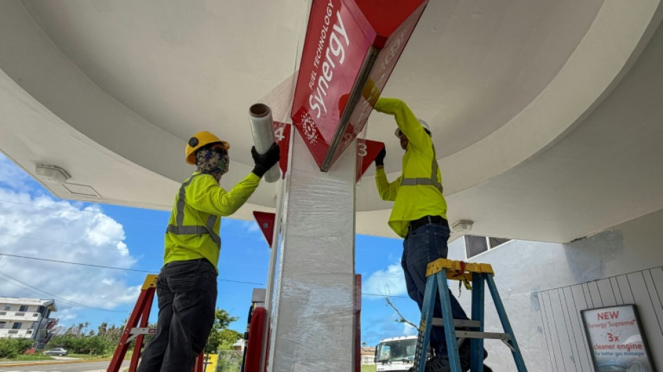
Residents of Guam and the Northern Marianas boarded up windows and stocked up Friday as a monster weather system forecast to become a "super typhoon" approached the US Pacific territories.
Just months after a previous major storm, cars queued at petrol stations, while residents thronged hardware stores to buy plywood and supermarkets for food, bottled water and other essentials.
"Current forecast tracks continue to indicate a grim outlook for the Marianas," the US National Weather Service warned.
"All residents across Guam and the [Northern Mariana Islands] should plan for and anticipate at least tropical storm conditions."
Typhoon Bavi was moving between the Marshall Islands and the Northern Marianas, with sustained winds of 167 kilometres per hour (104 miles per hour) and gusts of 203 kph, the Joint Typhoon Warning Center (JTWC) said in its latest update at 0300 GMT.
Moving west, it was projected to reach super typhoon status by Saturday morning, with sustained winds of 240 kph, increasing 24 hours later to 278 kph, the JTWC said, equivalent to a category-five hurricane.
It is expected to weaken very slightly by the time it arrives on Monday over Guam and the Northern Marianas -- which are still recovering from Super Typhoon Sinlaku in April.
Plans for celebrating the United States' 250th anniversary on Saturday have been quickly overtaken by storm preparations.
At the Pacific Islands Club Saipan resort, workers were boarding up windows, securing outdoor furniture and equipment, checking alarm systems and stocking first aid kits.
"Everyone has a role," the resort's sports, entertainment and activities manager Reymark Castro, 35, told AFP.
"From engineering to landscaping to operations, we're all working together to reduce damage and make sure we're ready to respond once the storm passes."
- Still recovering -
The Northern Marianas archipelago is home to around 40,000 people, and nearby Guam -- a separate US territory -- around 170,000. The area witnessed major battles in World War II.
Super Typhoon Sinlaku, which hit in mid-April, knocked out power for tens of thousands of people, uprooted trees, overturned cars and ripped metal roofs off buildings.
In the storm a cargo ship, the MV Mariana, suffered engine failure and overturned. The body of one crew member was recovered, and five others were missing, presumed dead.
"Some locals remain in temporary shelters or under makeshift roofs, while damaged seawalls continue to heighten concerns about storm surge," said the American Red Cross, which was deploying disaster teams and relief supplies ahead of Bavi's arrival.
"Two super typhoons in two months, in the same year, is a historic event," said Castro, who has sealed windows at his home with duct tape and filled up extra water containers.
"Never before seen, for the Marianas at least," he said.
The world's oceans experienced their hottest June on record and could set fresh highs in the months ahead, the European Union's Copernicus Marine Service said Wednesday.
Warmer oceans help tropical storms to intensify and add more moisture, which can fall as heavy rain.
The onset of a potentially powerful El Nino weather pattern could boost global heat in the oceans and atmosphere even further in 2026 and into next year, scientists say.
The natural climate phenomenon warms surface temperatures in the central and eastern equatorial Pacific Ocean, bringing worldwide changes in winds, pressure and rainfall patterns.
The World Meteorological Organization warned Friday that El Nino, which typically occurs every two to seven years and lasts nine to 12 months, has already begun in the tropical Pacific.
The United Nations' weather and climate agency said El Nino conditions were forecast to "strengthen rapidly over the coming months, increasing the likelihood of... extreme weather events in many parts of the world."
A.Kwok--ThChM