Hurricane Erin douses Caribbean, menaces US coast / Photo: © AFP

Hurricane Erin's massive footprint battered Caribbean islands with heavy gusts and downpours Monday, as it threatened rip currents and flooding along the US East Coast later this week even without a predicted landfall.
The Category 4 storm strengthened dramatically over the weekend in a historic burst of intensification scientists said was fueled by human-caused climate change. It briefly peaked as a Category 5 hurricane before weakening slightly.
In its latest advisory the US National Hurricane Center said the Atlantic season's first hurricane was packing maximum sustained winds of 140 miles (220 kilometers) per hour while moving northwest at 10 mph.
Erin is "unusually large," with hurricane force winds extending 80 miles and tropical storm winds extending 230 miles, the NHC said.
The storm's outer bands were forecast to dump rain across Cuba and the Dominican Republic through Monday as well as the Turks and Caicos and the Bahamas -- where a tropical storm warning is in place -- into Tuesday.
These regions could receive localized totals of up to six inches (15 centimeters) of rain, according to the NHC.
The agency's deputy director, Jamie Rhome, warned Americans not to assume the hurricane won't impact them simply because its track keeps it offshore.
"Nothing could be further from the truth for portions of the Mid-Atlantic, especially the Outer Banks of North Carolina," he said. On Wednesday and Thursday, waves of up to 20 feet (six meters), coastal flooding and storm surge "could overwash dunes and flood homes, flood roads and make some communities impassable," he said.
Evacuations have been ordered for two North Carolina islands, Ocracoke and Hatteras.
From Tuesday, much of the East Coast will face a high risk of life-threatening surf and rip currents, which occur when channels of water surge away from the shore.
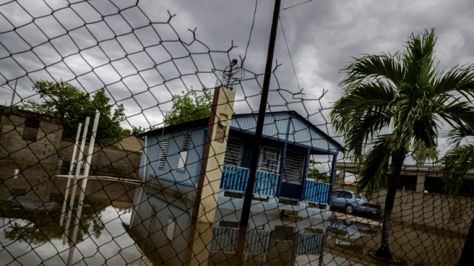
In Puerto Rico, a US territory of more than three million people, weekend flooding swamped homes and roads in the island's east, and widespread power outages left residents in the dark, though nearly all service has since been restored.
- Climate link -
"Erin is one of the fastest, most intensifying storms in the modern record," Daniel Gilford, a climate scientist at the nonprofit Climate Central, told AFP.
"We see that it has intensified over these warm surface temperatures -- and this makes a lot of sense, because we know that hurricanes act like heat engines taking up energy from the ocean surface, converting that energy into winds."
According to Climate Central, Erin traveled over waters whose extreme warmth was made up to 100 times more likely through climate change.
The Atlantic hurricane season, which runs from June 1 to November 30, has now entered its historical peak.
Despite a relatively quiet start with just four named storms so far, the National Oceanic and Atmospheric Administration (NOAA) continues to forecast an "above-normal" season.
A typical season produces 14 named storms, of which seven become hurricanes and three strengthen into major hurricanes.
This year, tropical activity is expected to be elevated by a combination of warmer-than-average sea-surface temperatures in the tropical Atlantic and Caribbean, along with an active West African monsoon, NOAA said.
Scientists broadly agree that climate change is supercharging tropical cyclones: warmer oceans fuel stronger winds, a warmer atmosphere intensifies rainfall, and higher sea levels magnify storm surge.
Climate change may also be making hurricanes more frequent.
P.Deng--ThChM